7.0 earthquake rattles Northern California, spurs anxiety before tsunami warning is canceled

- Share via
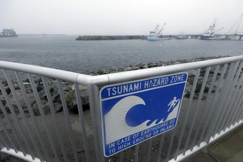
SAN FRANCISCO — A magnitude 7 earthquake about 30 miles off the Humboldt County shoreline prompted a highly unusual tsunami warning for a wide swath of the Northern California coast Thursday, spurring widespread evacuations before it was canceled an hour later.
The earthquake rattled large parts of the region — from San Francisco and Monterey to as far away as Sacramento, Reno and southern Oregon — providing a stark reminder of how coastal seismic activity can threaten to produce damaging tsunamis under the right circumstances.
Many reported terrifying shaking in and around the Eureka area, with bottles of alcohol shattered behind one bar, but there were no immediate reports of major injuries, likely owing in part to the epicenter being so far away from highly populated areas. Preliminary estimates indicate the epicenter was about 55 miles southwest of Eureka and 100 miles northwest of Mendocino.
Shaking of this strength is a reminder of the tsunami risk in California — particularly from closer-to-shore earthquakes like Thursday’s that would provide far less warning time to evacuate beaches and low-lying areas. Some of the most memorable damaging, and sometimes deadly, tsunamis in the last few decades occurred from earthquakes that started much farther away from land, such as in Japan, Alaska and Hawaii.
Centered under the Pacific Ocean about 70 miles southwest of Eureka, the strong quake frayed nerves across most of California’s North Coast.
The National Tsunami Warning Center in Alaska said it issued a warning quickly because there was so little time to get people out of harm’s way if a major tsunami did end up materializing.
Initially, there was no confirmation a tsunami was headed for the West Coast, but all the ingredients for one were present, said Dave Snider, the tsunami warning coordinator at the center.
After issuing the warning, his team spent the next 30 minutes to an hour working to understand how the earthquake shook the earth, confirming its magnitude and monitoring buoys and coastal lookouts for signs of a developing tsunami. Once those factors were considered, the warning was canceled just before noon.
“The feeling out there is, ‘Nothing happened, why did I evacuate?’” Snider said. “No, you did the right thing. ... It could have moved a lot of water. We’re glad it didn’t.”
A small tsunami — measured at 5 centimeters — did occur in Arena Cove off Mendocino County, Snider said.
Coastal areas in Northern California began evacuating residents after a 7.0 earthquake off Humboldt County’s coast prompted a tsunami warning. Luckily, the worst didn’t play out. But emergency procedures were appropriately taken, officials said.
Gov. Gavin Newsom said the earthquake is a reminder to be prepared.
“We’re concerned about damage, particularly in the northern part of the state and Del Norte, Mendocino and Humboldt County,” Newsom said at an unrelated news conference Thursday. He officially proclaimed a state of emergency in those counties to support response efforts.
State Senate President Pro Tem Mike McGuire (D-Healdsburg) said the hardest-hit region was the Eel River Valley in Humboldt County, which includes Rio Dell, Fortuna and Ferndale.
McGuire said he received reports of homes off their foundations in Fortuna and a gas main break at an elementary school in Rio Dell.
The hour or so the tsunami warning was in effect was marked by intense anxiety as jurisdictions across the Northern California coast issued evacuation orders for low-lying areas.
BART, the commuter rail system for the San Francisco Bay Area, suspended service through the underwater Transbay Tube connecting San Francisco and Oakland. Guests at the San Francisco Zoo, near the coast, were ordered to evacuate, with animals secured and staff moved to higher ground.
Thursday’s earthquake occurred at 10:44 a.m. “Very strong” shaking, as defined by the Modified Mercalli Intensity Scale, was felt in the Humboldt County communities of Petrolia and Ferndale. “Very strong” shaking is generally capable of causing considerable damage to poorly built or badly designed structures, according to the U.S. Geological Survey.
Residents in Petrolia, near the epicenter of the quake, reported seven to 10 seconds of shaking so intense that people found it difficult to stand up.
The USGS said “moderate” shaking was felt in Eureka, a level generally strong enough to break windows and dishes.
Even communities far from the coast took action. All schools in Davis, Calif., were ordered evacuated because of the shaking.
An inside look at the earthquake that rocked Humbolt County towns, including Rio Dell, Eureka, Fortuna and Ferndale.
Olivia Cobian, the innkeeper at the Gingerbread Mansion, a bed and breakfast in the historic town of Ferndale, said her 1895 building “looked like a war zone.”
“I have fireplaces flying forward.” she said. “Clawfoot tubs that have been lifted off [their mounts] and scooched over. This is crazy.”
Cobian said that moments before the quake struck, she had been giving a tour of the inn to a third-grade class from the local elementary school.
“They had just walked” back to school, she said, adding, “Thank God.”
“It’s insane,” she said, walking through the inn surveying the damage. Then, in the background, a siren began to wail. Cobian said she had to go talk to firefighters who had appeared.
The shaking at the Petrolia General Store was intense and lasted for about 10 seconds, according to employee Kaitlin Graves.
“It was a big earthquake. It was a lot of up-and-down shaking,” Graves said in a phone interview. “It felt like the woozy feeling you get when you’re in an elevator.”
The shaking was so intense it knocked several objects off the shelves, and multiple glass items shattered, Graves said.
“It was a very long-lasting and slow-rolling quake,” Humboldt Bay Fire spokesperson Talia Flores said of the shaking at the department’s headquarters in Eureka. “It was quite the scare.”
Thursday’s earthquake was followed by more than 30 aftershocks.

Humboldt County Supervisor Rex Bohn, whose district includes the earthquake zone, said there has been no major damage reported so far.
“I just talked to one of our local hospital providers ... and they seem to be doing OK,” he said.
“It’s a mess. There’s a lot of stuff off the shelves,” he added, but that seemed to be the extent of the damage at this point.
Thursday’s earthquake occurred near the Mendocino Triple Junction — a particularly seismically active area at the northern end of the San Andreas fault where three tectonic plates meet: the Pacific plate, the North American plate and the Juan de Fuca plate, USGS seismologist Elizabeth Cochran said.
The junction routinely has large earthquakes. The last one to strike the area was a magnitude 6.4 on Dec. 20, 2022. That occurred much closer to the coast — about two miles from land. Two people died from medical emergencies that happened during or just after the earthquake, and there were 11 injuries.
California is hit by about one tsunami a year, but most are barely noticeable. That said, if you live or work near the water or ever visit the coast, you should know what to do if there’s a big earthquake or a tsunami warning.
The force of the shaking shattered windows, sent objects flying and damaged at least one historic bridge in the small communities south of Eureka.
Another sequence of earthquakes hit exactly a year earlier, topping out with a magnitude 6.2 earthquake on Dec. 20, 2021.
The last earthquake larger than Thursday’s temblor to strike directly underneath land in Humboldt County occurred on April 25, 1992. Ninety-six people were injured in that earthquake, which caused considerable damage across southwestern Humboldt County, according to the USGS.
That earthquake triggered a tsunami with a maximum wave height — from trough to peak — of more than 3 feet to Crescent City. A magnitude 6.5 aftershock the next day sparked a fire, fueled by a broken gas main, that destroyed most of Scotia’s business district.
On Thursday, Steve Wells, a spokesman for the Fort Bragg Fire Department, said shaking in the coastal town was minimal and no damage had been reported. He said out of precaution, many residents were moving their boats out of the harbor in case of a sea swell.
In the community of Manila on Humboldt Bay, Jennifer Savage said she and her neighbors felt a long, rolling quake.
“People are pretty freaked out,” said Savage, who works at the Surfrider Foundation.
It’s a matter of when, not if, the Big One hits in California. Here’s what you need to have in an emergency kit and other tips for earthquake readiness and resilience.
When the quake hit, a crew of workers from the Pacific Gas and Electric Co. were perched high in the air, working on power lines. They swayed in the sky during the quake, she said.
At Ferndale’s Valley Grocery, a worker who decline to identified herself said that the quake knocked many products off the shelves but that no major damage had occurred.
On the social media site X, Caroline Titus, former publisher and editor of the Ferndale Enterprise, uploaded a series of videos and photos showing broken bottles, food cans and boxes on the ground of a hotel and grocer. Another video showed a tall headstone leaning slightly to the side. “Not one plate glass window out. Incredible,” she wrote on X. “And I was here for the three major quakes in 1992 and the last few December ones.”
Ferndale Police Chief Ron Sligh said there was no severe structural damage in the town. Two water mains broke, but they were being repaired, he said.
He said the town also experienced some power outages but they lasted only for a few minutes. He said schools have canceled classes for the day.
“We came out of it well,” Sligh said.
The San Andreas fault is capable of magnitude 7.8 earthquakes. Two have occurred twice in recent times: the 1906 San Francisco earthquake and one in 1857 in Southern California.
Renee Chappelle, a 77-year-old Eureka native, has lived through 15 to 20 earthquakes in her lifetime, five of those being of the 7.0 variety.
“It’s pretty usual for us in Humboldt County to get earthquakes,” she said.
Chappelle is the innkeeper of Hydrangea Inn, which was built by her great-aunt in the 1930s. The house was built from redwood and still has its original studs, so its sturdiness prevented it from sustaining any damage in the temblor, Chappelle said.
She said the shaking lasted at least nine seconds and while it wasn’t the strongest earthquake she has felt, it was definitely the longest.
Julie Symons, owner of Mitchell Grove, a wedding venue in Eureka, felt shaking from side to side. Her husband went out to check for damage, and they had only a small leak, which is already being taken care of by a plumber.
“It was a big earthquake,” she said. “It was a scary, and luckily I think a lot of people got their tsunami notices, which was amazing.”
Symons received her tsunami warning from Humboldt County on her phone at 12:11 p.m. Her husband got his notice even earlier.
“This was the biggest earthquake at Mitchell Grove since we’ve been here since 2013,” she added.
In San Francisco, Ocean Beach emptied out as emergency personnel drove up and down the shoreline around 11:45 a.m., saying, “Clear the beach, tsunami warning.” Fire personnel evacuated everyone off the sand portion of the beach, but dozens of people gathered along the paved waterfront to watch the waves roll in.
Dan Beniflah was walking his dog along the beach before fire personnel ordered everyone to evacuate. He said the warning felt like another tsunami scare in San Francisco that he remembers from decades ago.
He remembers sitting along the waterfront “drinking beer, waiting for it to happen” with scores of other people from the Sunset and Richmond neighborhoods. “But nothing ever happened,” he said. Like back then, the water Thursday “just looks normal.”
Earthquakes along strike-slip faults can cause tsunamis in certain contexts, a new model shows — and such faults exist right off parts of California.
Experts say it is critically important to evacuate low-lying coastal areas when a tsunami warning is issued — even if the tsunami doesn’t materialize or is far lower than expected.
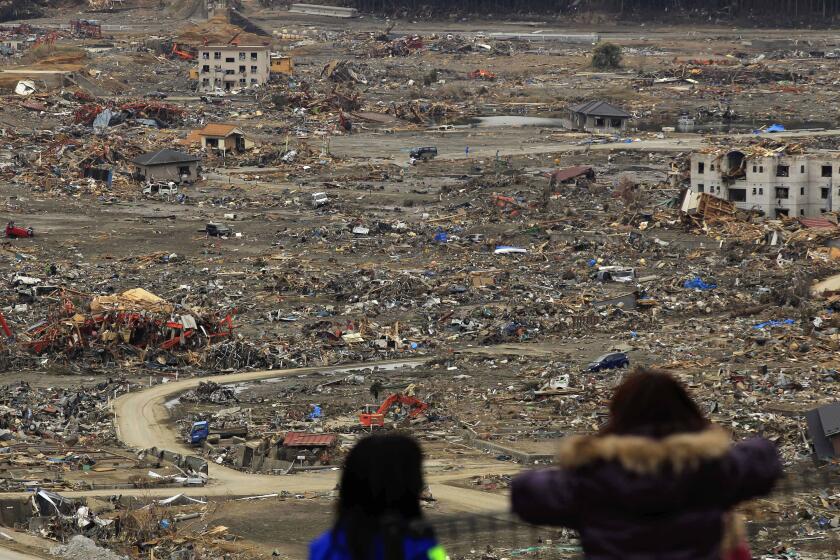
In Japan in 2011, initial predictions of tsunami height triggered from a magnitude 9 offshore earthquake underestimated the actual height. More updated revisions didn’t reach everyone — because of communications failures due to the earthquake. Nearly half of residents got no tsunami warnings or evacuation orders in the areas ultimately hit by the tsunami, and 60% to 70% didn’t get the revised warnings of the rising tsunami heights. Some people evacuated, but some others didn’t.
About 160 miles southeast of the earthquake Thursday, there was also a report of a magnitude 4.1 earthquake near Cobb, Calif., at 10:47 a.m.
In Cobb, Armond Urbano, who runs the pro shop at Adams Springs Golf Course, said he wasn’t aware of much damage.
“The chandeliers in the dining room were shaking a little bit, but that was about the extent of it,” he said.
California’s worst tsunami disaster in modern times occurred in 1964, when a magnitude 9.2 earthquake in Alaska spawned a tsunami that inundated Crescent City, near the Oregon border. Thirteen people died, and damage exceeded $160 million in today’s dollars, the California Geological Survey said.
Tsunamis are a disaster upon a disaster upon a disaster. So why do we still know so little about them?
A nightmare scenario for California would be something like the disaster that occurred in 1812, when a large earthquake in the Santa Barbara area “was followed by a tsunami that wiped out many coastal villages and destroyed ships in the harbor,” according to the USGS.
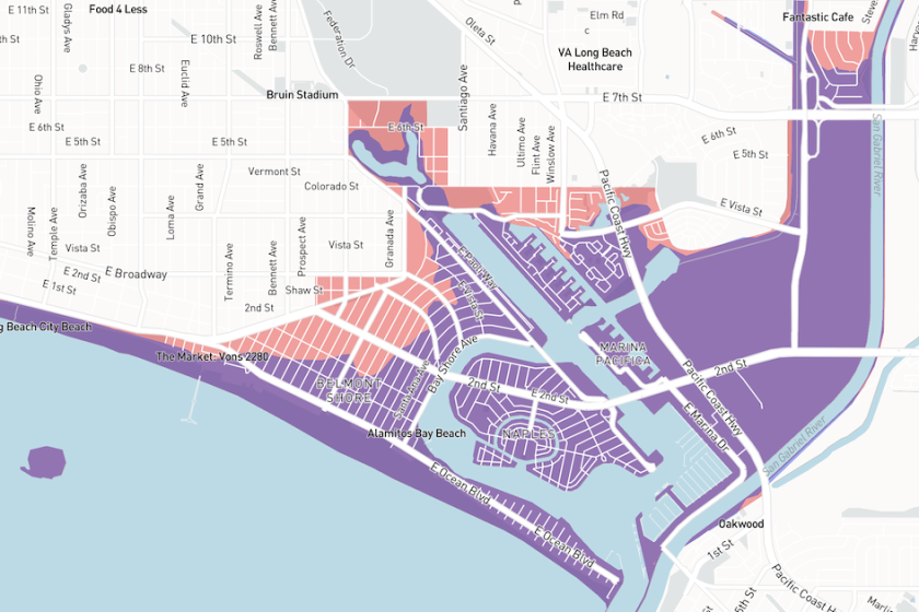
Another scenario involves an earthquake in the Santa Barbara Channel that could spawn tsunamis in Carpinteria, Santa Monica and points farther south. Some neighborhoods close to the coast in other tsunami scenarios — such as Balboa Island in Newport Beach — could struggle to evacuate, especially if there are only narrow roads around to evacuate.
The earthquake occurred at a depth of 6.2 miles. Did you feel this earthquake? Consider reporting what you felt to the USGS.
Find out what to do before, and during, an earthquake near you by signing up for our Unshaken newsletter, which breaks down emergency preparedness into bite-sized steps over six weeks. Learn more about earthquake kits, which apps you need, Lucy Jones’ most important advice and more at latimes.com/Unshaken.
Times staff writers Salvador Hernandez, Summer Lin, Taryn Luna, Jasmine Mendez and Grace Toohey contributed to this report.
More to Read
Sign up for Essential California
The most important California stories and recommendations in your inbox every morning.
You may occasionally receive promotional content from the Los Angeles Times.

